
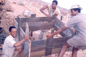
Civil Eng Construction Supervision
Construction Site Survey
Engineering Hydrology
Irrigation Engineering
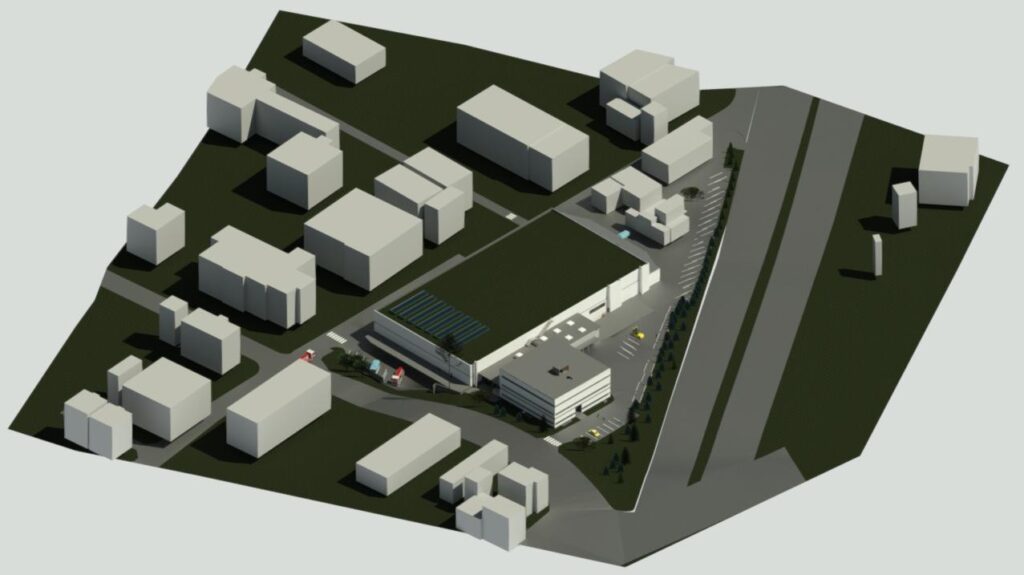
3D modelling
Civil Eng Construction Supervision
We specialize in the supervision of construction projects, including building structures, hydraulic works such as dams, irrigation infrastructure, and water reservoirs.
The site supervisor (site manager) plays a critical role in overseeing the project, with responsibilities including:
- Ensuring that all work is carried out in accordance with the approved drawings and specifications, and providing guidance to junior technical teams (staff),
- Resolving technical challenges, monitoring safety issues, and regulating quality control standards,
- Measuring and assessing quantities in collaboration with the quantity surveyor (expert in quantity evaluation),
- Ensuring that materials purchased or ordered meet the designated requirements and specifications,
- Validating and confirming that the drawings for finished works, as provided by contractors, align with the approved plans,
- Verifying that the contractor conducts necessary tests and evaluations on materials before use, such as concrete strength tests, water tanks, water pipes, sewers, and other construction materials. Concrete is typically designated as M10, M15, M20, etc., indicating its resistance in N/mm² after 28 days. The supervisor also checks that the concrete mix proportions are appropriate (e.g., 1:3:6, 1:2:4),
- Monitoring the placement and scheduling of reinforcement bars,
- Making decisions regarding any required changes to the detailed drawings provided by the contractor.
Our firm can provide qualified supervisors to guide your projects and help you achieve your objectives with the highest standards of quality and efficiency.
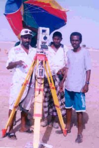
CONSTRUCTION SITE SURVEYING
A topographical survey is essential on construction sites to accurately locate and measure features, elevations, and slopes, ensuring that the terrain is suitable for the proposed construction projects. It provides valuable insights for the planning and potential use of land for industrial, commercial, and residential buildings, schools, and other structures such as dams, irrigation infrastructure, and more. Along with contour maps and boundary surveys, topographic maps are crucial tools used by architects and engineers to create precise designs based on existing land features.
The benchmarks, staked out by the surveyor, serve as reference points to guide the construction process. At the start of the project, the surveyor translates the paper plans onto the terrain to enable contractors to begin construction. Additionally, a final survey is conducted upon project completion to ensure that the work aligns with the specified plans. As such, surveying is a fundamental aspect of any construction project.
Although technological advancements have enhanced the accuracy of surveying, a skilled surveyor or civil engineer is critical to ensuring the reliability of the results. Our team is highly qualified and proficient in performing Total Station surveys, providing computer-generated topographic and contour maps with exceptional detail and precision for any desired project site.
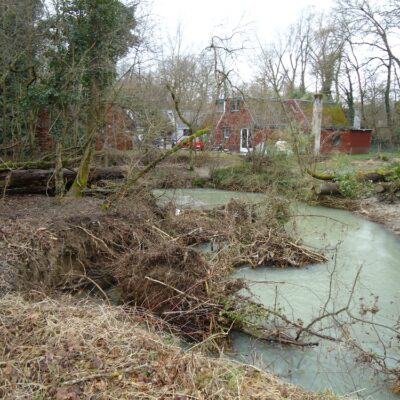
HYDROLOGICAL STUDIES AND DESIGN
The role of a hydrologist in society is crucial as it focuses on the management and analysis of water resources. Hydrologists examine and interpret hydrological data to assess risks such as flooding and drought, and develop strategies for mitigating these challenges. They investigate the impact of land-use practices, including irrigation and deforestation, on specific areas and analyze the associated consequences. Additionally, they assess the water budget of a catchment area and prepare comprehensive water use plans.
Hydrologists oversee the collection and evaluation of data using specialized hydrological and statistical techniques. They collaborate with hydrometric teams to set up, maintain, and calibrate critical monitoring equipment, such as devices for measuring water levels, rainfall, and sediment.
Hydrologists are responsible for preparing inundation maps, predicting rainfall and runoff, and formulating strategies to manage water flow effectively and mitigate potential risks.
They work in close collaboration with engineers on a variety of projects, including irrigation, road construction, dam development, and water reservoir management.
Our team is dynamic and well-equipped with the latest technologies and widely accepted hydrological models. Most importantly, we collaborate closely with leading experts and scientists to deliver the most accurate and effective solutions.
Read more
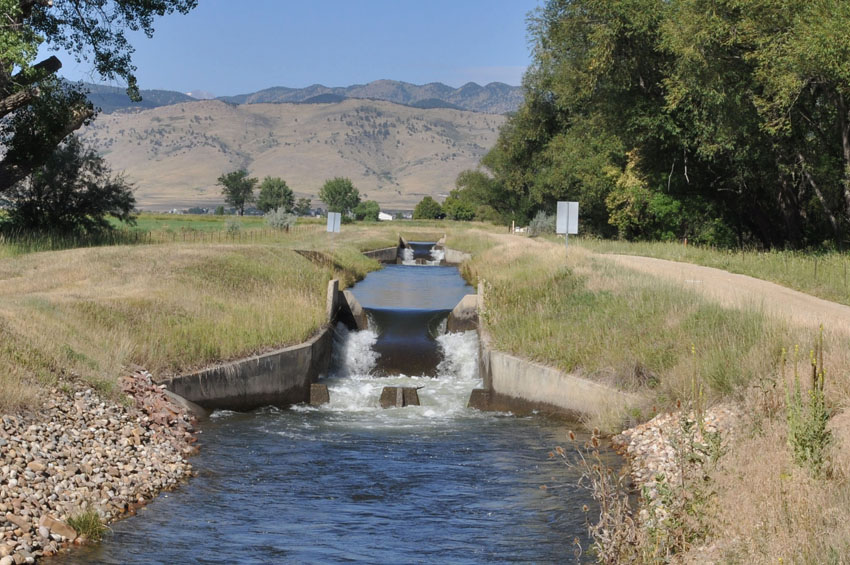
IRRIGATION
Our team excels in the assessment, planning, and design of comprehensive irrigation systems, including canals, barrages, drains, drop structures, turnouts, culverts, weirs, levees, dams, siphons, and more.
We conduct detailed analysis of soil types and estimate plant water requirements to ensure efficient irrigation management.
Our experts oversee topographic surveys of irrigation command areas, plan and place canal structures, and provide guidance throughout the construction phase in the field.
We prepare precise technical designs, including detailed drawings and bills of quantities, and offer valuable support in preparing tender documents and contracts.
Our team also specializes in the design and construction of drainage networks, addressing challenges such as waterlogging and ensuring optimal water management.
Additionally, we are proficient in utilizing advanced tools such as Excel, CAD, ArcGIS, and CROPWAT 8 to support the planning and design process, ensuring accuracy and efficiency.
Read more
CONSTRUCTION SUPERVISION AND DESIGN
We specialize in 3D building modeling using Revit and can transform your AutoCAD 2D designs into detailed 3D models.
Send us your AutoCAD 2D model design via: ![]() (wetransfer.com)
(wetransfer.com)
Alternatively, you can contact us via email at Email.
We will convert your design into a 3D model for you.
Distance is not a barrier, and there are no limits to what we can achieve!
We also offer the rental of Total Stations on an hourly or daily basis, with or without a surveyor.
For online support: ![]() (TeamViewer Online Support)
(TeamViewer Online Support)
Our Group
Our team consists of highly skilled specialists in the fields of engineering hydrology, civil engineering, and irrigation, enabling us to offer expert services in these areas. We also collaborate regularly with distinguished professionals who are leaders in their respective fields, ensuring that we deliver cutting-edge solutions.
With extensive practical experience across diverse regions, including Eritrea, Ethiopia, South Africa, and Switzerland, our team excels in areas such as hydrological design, catchment studies, hydraulics, irrigation infrastructure, 3D building modeling, dam construction, and the supervision of building projects. This global expertise allows us to tackle complex challenges and deliver exceptional results for our clients.
![]()
Vision Statement
Teamwork and harmony between team members are the keys of many successful companies
 Structural Engineer
 CIvil Eng & Hydrologist
- Water Supply and sewerage Expert
- Quantity Surveyor
- Designer (CAD, Civil 3D, & Revit
- Land surveyor (Certified)
- (HVAC) building experts